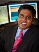
Dr. Thomas Oommen
Assistant Professor, Geological and Mining Engineering and Sciences
 Dr. Oommen’s
research is focused on the application of remote sensing for
geohazard characterization. His research group uses machine
learning and pattern recognition algorithms to efficiently
classify or cluster remote sensing data to characterize
hazards. One area of his research evaluates the use of
crowd-sourcing to analyze earthquake-induced damages in
remotely sensed imagery. The advent of Web 2.0 technologies
and the ubiquity of free remote-sensing images possess three
components of high resolution -- spatial (measure of the
smallest object that can be identified), spectral (the specific
wavelengths that a sensor can record), and temporal (how often
a sensor can obtain imagery) -- have made crowd-sourced damage
assessment possible. The benefit has already been demonstrated
-- delivery of damage estimates two to three times faster than
previously. However, detailed ground assessment also
highlighted the limitation of this approach and the
variability in accuracy of damage assessment with varying
expertise of the crowd volunteers. To overcome this limitation,
Dr. Oommen proposes automating key tasks using state-of-the-art
machine learning and image processing and shifting the role of
the volunteer crowd from manual image interpretation to
supervised guidance of the automated tasks for mapping and
classifying damage. This study is conducted in collaboration
with Dr. Umaa. D. Rebbapragada, a Machine Learning Scientist at
the Jet Propulsion Laboratory, California Institute of
Technology.
Another area of research that Dr. Oommen’s group is evaluating
is, the use of a variety of remote-sensing techniques, from
Optical Photogrammetry (OP) to Light Detection and Ranging
(LiDAR) to Interferometric Synthetic Aperture Radar (InSAR) to
manage geotechnical assets along the transportation corridor.
The one common theme for US transportation infrastructure is
that it is supported by the ground, constructed over it,
through it or next to it. Scientists call these natural bases
geotechnical assets. The problem, however, is that we do not
have a comprehensive program in the US to monitor the
geotechnical assets of our transportation corridors.
Dr. Oommen says that it is highly likely that cameras mounted
on unpiloted aerial vehicles (UAVs), cars and trains will
monitor entire transportation networks automatically, sending
remotely sensed imagery back for analysis of potential
instability. Co-investigators on this research include
Colin Brooks,
senior research scientist at the Michigan Tech Research
Institute (MTRI);
Pasi Lautala,
assistant professor in civil and environmental engineering;
Stan Vitton,
associate professor in civil and environmental engineering; and
Keith Cunningham,
a research professor from the University of Alaska Fairbanks.
For more information, please visit Dr. Oommen'
website.
Recent publications
| 01 |
A Study of the Impacts of Freeze-Thaw on Cliff Recession at the Calvert Cliffs in Calvert County, Maryland B. Zwissler, T. Oommen, S. Vitton Geotechnical and Geological Engineering, vol. 32, p. 1133 (2014) |
| 02 |
Hazard Assessment of Rainfall-Induced Landslides: A Case Study of San Vicente Volcano in Central El Salvador D. M. Smith, T. Oommen, L. J. Bowman, J. S. Gierke, S. J. Vitton Natural Hazards (2014) |
| 03 |
Numerical Modeling of Volcanic Slope Instability and Related Hazards at Pacaya Volcano, Guatemala L. N. Schaefer, T. Oommen, C. Corazzato, A. Tibaldi, R. Escobar-Wolf, W. I. Rose Bulletin of Volcanology, vol. 75, p. 720 (2013) |
| 04 |
Documenting Earthquake-Induced Liquefaction using Satellite Remote Sensing Image Transformations T. Oommen, L. G. Baise, R. Gens, A. Prakash, R. P. Gupta Environmental & Engineering Geoscience, vol. 19, p. 303 (2013) |
| 05 |
An Objective Analysis of Support Vector Machine Based Classification for Remote Sensing T. Oommen, D. Misra, N. K. C. Twarakavi, A. Prakash, B. Sahoo, S. Bandopadhyay Mathematical Geoscience, vol. 40, p. 409 (2008) |

